Skip to content

About

  • Download Quiver
  • About Quiver
  • Features
  • Roadmap
  • What's New
  • Quiver vs Surfline
  • For Businesses
  • For Surf Schools

Browse Beaches

  • United States
  • Mexico
  • Puerto Rico Surf

Forecasts

  • Free Surf Reports
  • 7-Day Forecast
  • Live Surf Cams
  • Best Time to Surf
  • Forecast Accuracy
  • Water Temp

Explore

  • Beginner Spots
  • Tide Charts
  • Dawn Patrol
  • Sunset Sessions
  • Less Crowded
  • Longboard Spots
  • Surf Guides
  • Surf Game
  • Surfer's Toolkit

Legal

  • Privacy Policy
  • Terms of Service

© 2026 Quiver Surf. All rights reserved.

Quiver
FeaturesLive CamsToolsRoadmapWhat's NewAbout
FIELD GUIDE · CHARLESTON

Sunset Bay State Park

Charleston, OR

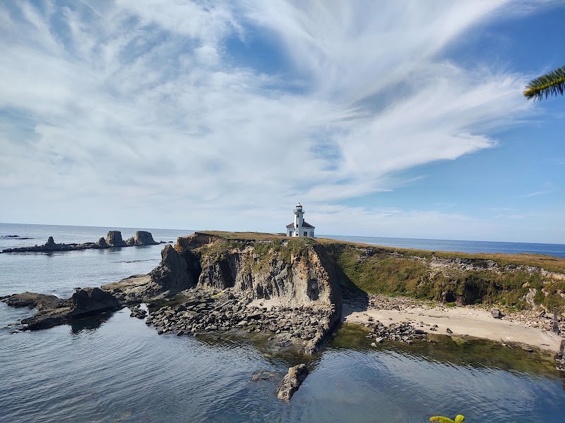
Sunset Bay State Park, Charleston, ORPhoto by Paul S. Darr via Google

Sunset Bay State Park Surf Forecast for Wednesday, November 11, 2026

Checking rip currents…

Explore forecast
Latest forecast for Wednesday, November 11, 2026
Surf
9-10 ft
General forecast
MEH
Skip it
Same for every surfer. Not adjusted for your level or boards.
Get your call
Best window
2:30 PM–5:00 PM
Primary swell
10 ft @ 9s W
Wind
19 mph SW onshore
Tide
Falling · 7.8 ft · next low
Confidence
91/100
Sources & forecast details
Secondary swell
0.4 ft @ 5s SSE

Valid Wed 4:00 PM America/Los_Angeles · Source updated Wed 8:30 AM · Computed Wed 12:16 PM · NOAA NWS, NOAA COOPS, Open-Meteo, NOAA CO-OPS

Forecast accuracy & methodology

Nearby spots

Bastendorff BeachBandon

Today by time

Sunset Bay State Park Hourly Surf Forecast

Latest daily forecast · Wed, Nov 11 · America/Los_Angeles. Separate from the selected day above.

Sunset Bay State Park today hourly surf forecast with surf height, the Quiver call, swell, wind, tide, and confidence.
TimeSurfQuiver callSwellWindTideConfidence
1:00 AM9 ft—6.4 ft @ 10s W (6.3 ft @ 9s W)23 mph SW6.4 ft · Rising94%
4:00 AM9 ft—9.2 ft @ 9s W (0.9 ft @ 5s S)17 mph SSW5 ft · Falling92%
7:00 AM8.4 ft—8.1 ft @ 9s W (3.7 ft @ 6s SW)26 mph S3.6 ft · Rising95%
10:00 AM8.5 ft—8.1 ft @ 10s W (3.7 ft @ 6s SW)16 mph SSW6.4 ft · Rising94%
1:00 PM8.8 ft—9 ft @ 10s W (0.5 ft @ 6s SSE)22 mph SW7.8 ft · Falling92%
4:00 PM9.7 ftBest window10 ft @ 9s W (0.4 ft @ 5s SSE)19 mph SW3.6 ft · Falling91%
7:00 PM10.4 ft—10.7 ft @ 9s W (0.1 ft @ 4s SSE)14 mph S-0.4 ft · Rising89%
10:00 PM10.7 ft—10.8 ft @ 10s W (0.1 ft SSE)12 mph SSE1.9 ft · Rising88%
About this spot · ratings & ideal conditions
LOWER-INTERMEDIATE
BEACH BREAK

Mid tide, E wind, 4-8 ft W swell

Spot map
SUNSET BAY STATE PARK
CHARLESTON, OR
Map showing Sunset Bay State Park at its actual locationCharleston, OR
Quiver · Field Guide · Charleston, ORUpdated NOV 11, 2026QUIVER //

Selected day: 2026-11-11 · America/Los_Angeles

Surf Guides for Charleston

Explore all Charleston surf spots
Tide Charts

Track tide swings for optimal sessions

Sunset Bay State Park Tide Chart

Next high and low at this spot

Dawn Patrol

Early morning sessions

Sunset Sessions

Golden hour surf windows

Beginner Spots

Mellow waves for learning

Longboard Spots

Cruisy waves for logging

Water Temp

Current ocean temps

Wave Period Explained

What the seconds in a forecast mean

Nearby Spots

close to here →
Explore all nearby spots →
Bastendorff Beach photo

Bastendorff Beach

7.3ft·lower-intermediate
Coos Bay, OR
Bandon photo

Bandon

7.3ft·beginner-intermediate
Bandon, OR