

Key Takeaways
- Read a surf report in this order: period, direction, wind, tide, then height. Height is the last number to trust by itself.
- Two sessions with the same height can surf completely differently because period, tide, and direction change the wave's power and shape.
- If you're confused by a session, check period first. It often explains more than the headline height.
- A good swell at the wrong angle is still the wrong swell for your break.
- When board choice feels mysterious, it's usually because the wave shape changed, not just the size.
- Tide does not just raise and lower the water. It changes how and where the wave breaks.
- Read surf reports in the same order every time so you stop chasing a misleading height number.
The Short Answer
To read a surf report or surf forecast, do not start with wave height. Start with period for power, direction for whether your break receives the swell, wind for surface quality, tide for shape, then height for scale. The same reported 2-4 ft can be weak and longboard-friendly one day, then steep and shortboard-only the next. Local beach shape decides how those numbers translate once the swell hits shore.
Why the Same 2-4 Ft Day Can Feel Totally Different
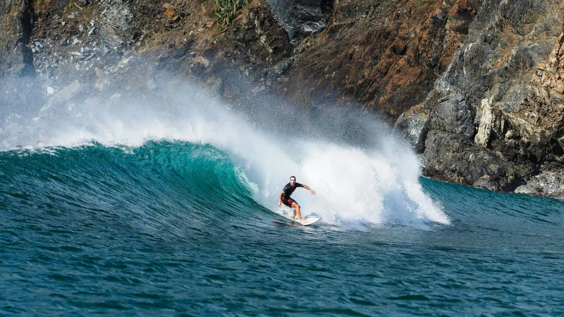
This is the beginner trap: the forecast says 2-4 ft, but when you show up everyone else is on shortboards and your longboard suddenly feels wrong. Usually the missing variable is period. A small swell at 7-9 seconds is often soft local windswell. A small swell at 13-16 seconds has real push, stands up earlier, and throws steeper takeoffs.
Then layer in tide and direction. A long-period south swell hitting the right sandbar at mid tide can make a beach break feel punchy even when the headline number still looks modest. That is why experienced surfers seem to “just know” which board to bring. They are not reading one number. They are reading how the whole combo fits that spot.

Why the Same 2-4 Ft Day Can Feel Totally Different
Two sessions with the same height can surf completely differently because period, tide, and direction change the wave's power and shape.
Start with Period Before You Judge Height
Period is the time between waves in seconds. It is the fastest way to separate weak surf from quality surf. Short period, like 6-9 seconds, usually means local wind energy, closer-spaced waves, and less push. Longer period, like 12-16 seconds, usually means distant storm energy with cleaner lines and more force behind every takeoff.
For beginners, period is often the answer to “why was I undergunned?” A longboard that feels great in weak 3 ft @ 8s surf can feel sticky and late in 3 ft @ 15s surf because the wave is standing up faster. Height tells you the rough scale. Period tells you whether that scale will actually matter.
Start with Period Before You Judge Height
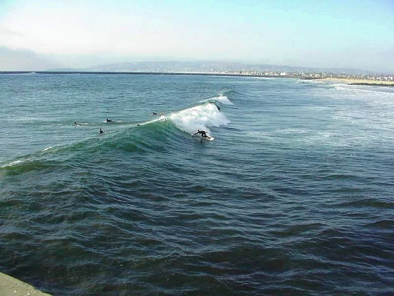
Direction Only Matters if Your Break Faces It
Swell direction tells you where the energy is coming from. But that number only helps if your beach is exposed to that angle. One nearby break might love south swell and another might be shadowed and nearly flat on the same day. This is where local knowledge starts to compound.
When you're learning a spot, stop asking “is 3 feet good?” and start asking “does this beach like south, west, or northwest swell?” A modest swell from the right angle can be better than a bigger swell from the wrong one. Quiver models this with beach-specific calibration for exposure and shoaling, because nearby beaches do not translate the same raw swell in the same way.
A good swell at the wrong angle is still the wrong swell for your break.
Wind Changes Board Choice More Than Beginners Expect
Wind is not just “good” or “bad.” Offshore wind cleans up the face and can hold a wave open longer. Onshore wind adds bump and makes sections crumble. Cross-shore wind can still be fine if it's light. That is why you can get advice like “the arrows look okay” and still miss the real call: light cross-shore with weak period is completely different from light cross-shore with long-period punch.
Board choice lives in that difference. On a mushy day you want glide and foam. On a steeper, more powerful day you often want something that gets in later, sets rail quicker, and fits the pocket better. If you're deciding between longboard and shortboard, compare period + wind + tide before you compare height.
Tide and Bottom Shape Decide Whether Waves Feel Friendly or Heavy
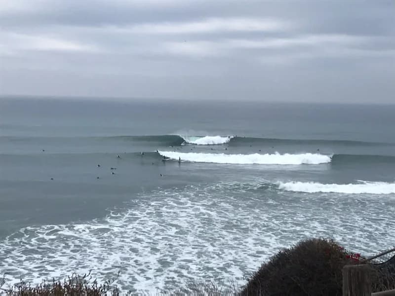
Tide changes water depth over the sandbar, reef, or point that is shaping the wave. Low tide can make a wave stand up fast and hollow out. High tide can slow the same wave down or swamp it completely. Mid tide is often the most forgiving at beach breaks, but not always. Some points want more water. Some reefs get sketchy below a certain tide.
This is also where beach shape matters. Two neighboring beaches can receive the same buoy swell, but one will focus energy into a punchy peak while the other spreads it into softer shoulders. That's why “what should I look for?” eventually becomes “what should I look for at this spot?”

Tide and Bottom Shape Decide Whether Waves Feel Friendly or Heavy
Tide does not just raise and lower the water. It changes how and where the wave breaks.
A 30-Second Way to Read a Surf Report Before You Drive
Use this order every time you open a surf report:
- Period: is this weak windswell or ground swell?
- Direction: does my spot actually receive this angle?
- Wind: clean, cross, or blown out?
- Tide: is the break in its usable window?
- Height: now that I trust the setup, how big is it really?
If you want to get good fast, log a few notes after every surf: period, direction, tide, wind, and which board felt right. After 10 to 20 sessions at the same beach, the numbers stop being abstract and start matching what you feel in the water.
The data behind those checks is public and transparent: NOAA/NWS WaveWatch-style marine forecasts, NDBC/CDIP/IOOS buoy observations where available, NOAA CO-OPS tides, and Open-Meteo for some wind and extended-horizon coverage. The hard part is not getting numbers. It's learning which numbers matter most for your break.
Want the read done for you? Quiver scores 280+ breaks by tide, wind, and swell and learns the days you rate — see how it compares to Surfline or vote on what we build next. Runs in any browser, or get the iOS app.
A 30-Second Way to Read a Surf Report Before You Drive